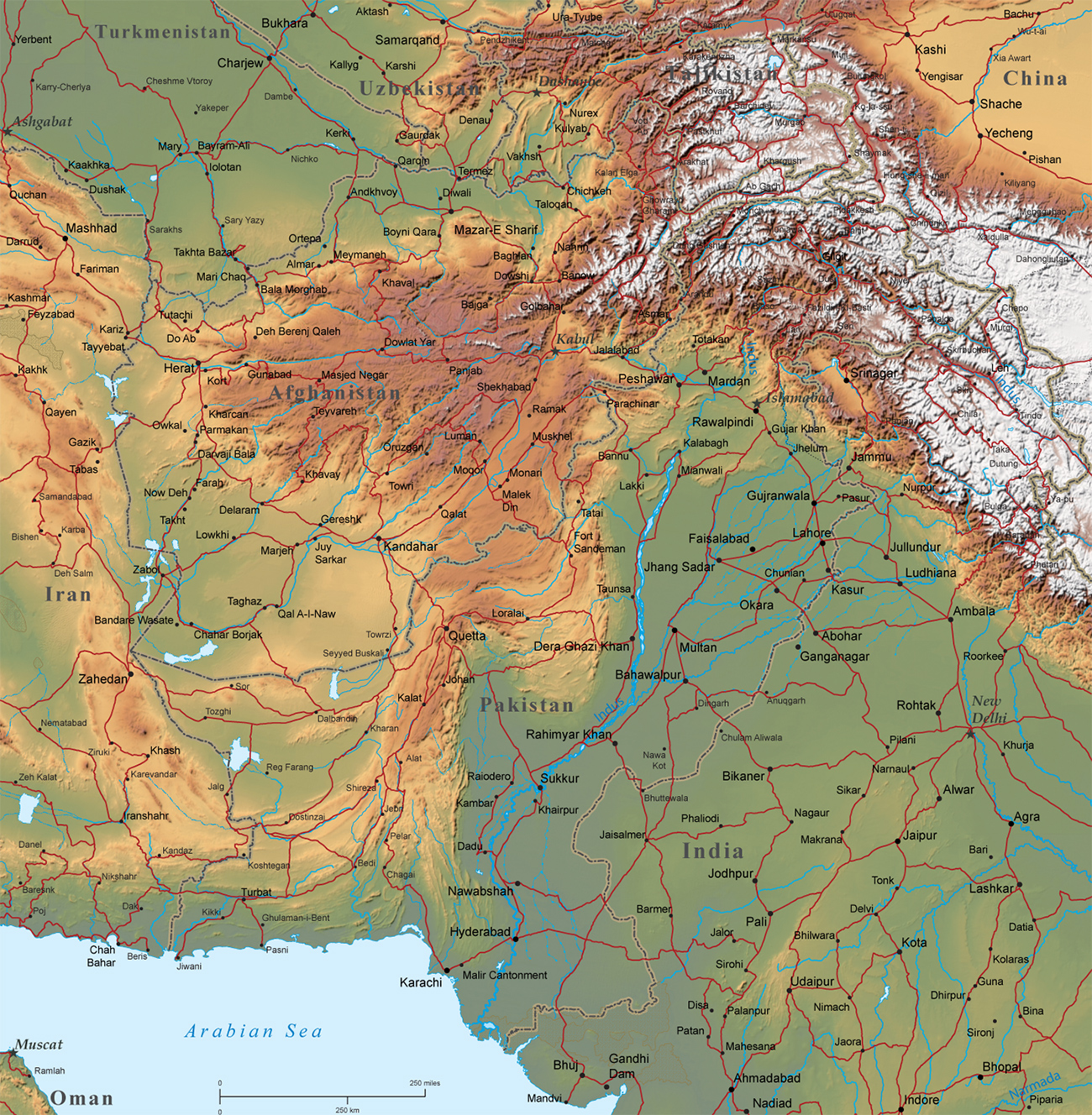
Physical Map of Afghanistan
|
Copyright © Geographic Guide - Asia Atlas, Maps of Countries. |
Afghanistan is a landlocked country located in south-central Asia. It was part of the Persian Empire. An Arab invasion in the 7th century introduced Islam. Border countries: China 91 km, Iran 921 km, Pakistan 2,670 km, Tajikistan 1,357 km, Turkmenistan 804 km, Uzbekistan 144 km.
The Afghan terrain is mostly rugged mountains; plains in north and southwest. highest point is Noshak 7,492 m. Natural resources include: natural gas, petroleum, coal, copper, chromite, talc, barites, sulfur, lead, zinc, iron ore, salt, precious and semiprecious stones, arable land.
Physical Map of Afghanistan