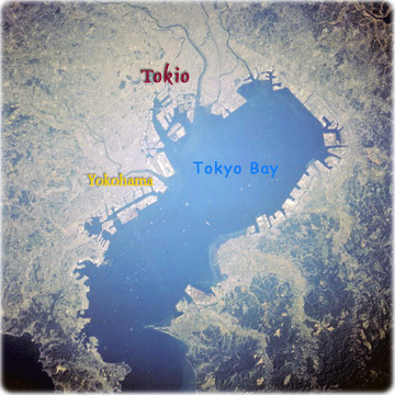
Map of Tokyo
Tokyo, Japan October 1993 (NASA). The Tokyo-Yokohama-Kawasaki urban area is the world’s largest metropolis. The docking facilities around the periphery of Tokyo Bay reflect the country’s emphasis on international trade. Although volcanism, earthquakes, and plate tectonics modify the physiography of Japan, no volcanoes are visible in this photograph. The Tokyo region has a dynamic environmental history because of its proximity to the intersection of three major, active tectonic plates (Eurasian, Pacific, and Philippine) that collide southwest of Tokyo Bay. Much of the industrial infrastructure around Tokyo Bay has been built on landfill materials, from which artificial islands are sometimes created. Because landfill materials can liquefy during earthquakes, there is concern that a major earthquake could generate tremendous destruction in this densely populated area. In spite of strict building regulations that have been imposed during recent decades, a major earthquake could have a calamitous impact on this area and all of Japan.

|
Copyright © Geographic Guide - Asia Atlas, Maps of Countries. |

